Nov 27, 2011

Ranger Biv

With a fine weekend forecast, I took advantage of the good conditions for a longer weekend trip to visit Ranger Biv. Ranger is one of the few remaining original biv's in the Arthur's Pass area and is continued existence and maintenance is due in no small part to the care and attention lavished on it by Frank King and Henora Renwick. See: http://tramping.typepad.com/tramping_report/2005/10/ranger_biv_upda.html


From the Andrew's Shelter a good four and a half hours walk took me to my lunchtime stop at Casey Hut. I opted for the track above the Andrew's Gorge, figuring that walking out through the gorge on the return trip would be a nice way to finish the tramp. Morning tea was at the first flats after the track descends to the river, at one of the many great camping spots along this section of the route. I was passed by two runners whilst on the Hallelujah Flat, they were running in to Casey Hut and they passed me once again on their return leg whilst descending through the final sections of bush to Casey Hut.


Looking back to the Andrew's Bridge from the start of the track.


Red Beech Forest on the early section of the Andrew's Track.


Trail runners on Hallalujah Flat.

After lunch I forded the Casey Stream opposite the hut and carried along the short section of track that soon dropped above the Poulter River terraces. The Fenwick Stream, which is the starting point for the Ranger Biv route was clearly visible from here and I tramped line of sight, fording the many channels of the Poulter, wide and deep in places but slow moving.


Casey Hut from the far side of the Casey Stream.


Poulter River Valley - south to Peveril Peak.

The lightly marked route to Ranger begins at the point the Fenwick Stream enters a small chasm and is marked by cairns and tape. It climbs gradually through the bush, never overly steeply and is occasionally marked when needed. Further up there were some sections through deadfall and regrowth were I briefly lost the track, but it is generally straightforward. The Biv itself is idyllically situated in a small clearing, just below the 1300m mark. A stream runs next to it and below it a long pool is shaded by the bush. I was the third party to visit it in 2011. After visiting the biv, I climbed up to Pt. 1371 and camped on the bush edge just below this minor top.


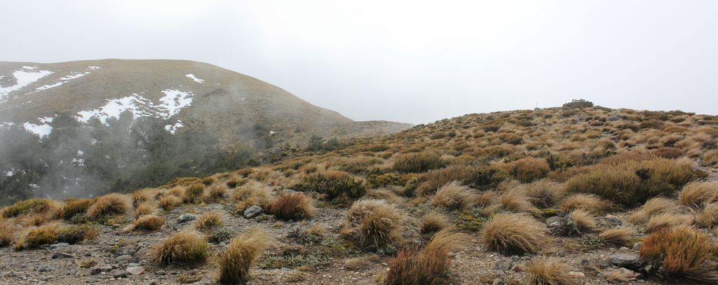
Part of the Poulter Range from near Pt. 1371


The Range Biv from above.


Ranger Biv.


Range Biv - interior.

Sunday was a long ten and a half hour day , which started with a traverse of the Poulter Range. The climb up to Pt. 1666 was straightforward and I was soon on top of the range. From here the views are spectacular. To the west, the Poulter Valley with Mt Valiant beyond. The dramatic drop to the Cox River to the east, and north to the Poulter Range continuation and Mount Row.


The Poulter Rive Valley. From Left to right:
Brown Hill, Casey Saddle and Stream, Green Hill, Castle Hill,
Poulter River towards the Worsley Pass, Mount Scarface.


Poulter Range (south) from the ascent of Pt 1666


Poulter Range (north) towards Mt Row and Pt. 1754.

The traverse south to Forest Peak was straightforward with just a couple of points that might be considered slightly airy. There was a fair amount of ascent and descent on the ridge traverse though and I took the opportunity for morning tea break on top of Pt. 1740, the highest part of the ridge traverse, before continuing on mixed rock, grass and scree out to Forest Peak.


On the traverse of the Poulter tops.


Pt. 1740, the highest on my range traverse.


Morning Tea on top of Pt. 1740. Poulter river left.


The middle section of the ridge before Forest Peak.

I descended from Forest Peak off an obvious NW spur, which was clearly visible from the flat area SW of the main summit. This was generally a very good descent. The top section had good deer tracks and lower part was mainly through open Red Beech forest. Only in the middle part was any significant spindly regrowth encountered.


Poulter River looking South, from Forest Peak.


Great open bush on the spur off of Forest Peak.

After refording the Poulter River I again stopped for lunch at the Casey Hut, knowing I still had at least a four and a half hour walk ahead of me. However with a nice tail wind and a slightly overcast sky it wasn't very arduous and I soon found myself heading down the Andrew's Gorge in the late afternoon. This was fantastic for my sore feet and a really fun way to finish the trip.


Back in the Poulter Valley, with some non native wildlife.


Back across the Poulter River.


Heading across the Casey Saddle.


In the Andrews Gorge.


In the Andrew's Gorge.

Distances:
Saturday: 20km / 1265m ascent, 600m descent / 7h45m
Sunday: 25km / 1150m ascent, 1800m descent / 10h45m

Nov 9, 2011

Christchurch Pop Up Mall

Cashel Mall reopened, some 9 months on from the February 22nd earthquake.


Christchurch Pop-Up Mall.


Chistchurch Pop-Up Mall.


Christchurch Pop-Up Mall. Formally Whitcoull's Site.

Oct 30, 2011

Hawdon Hut

A nice relaxing weekend tramp in to Hawdon Hut with Darrin and Gill, in sometimes grotty weather conditions. However a cosy hut and good company more than made up for it.


The lower section of the Hawdon Valley is pretty wide and there is a fair amount of gravel bashing involved. The Hawdon itself has to be forded at least three times on this route and although the fords are good, this could potentially be problematic.

From the Hawdon Shelter a short section of track heads through the bush before dropping down to the valley floor. The Sudden Valley Stream, a good trip in it's own right is soon passed. DOC trappers were working this section on quad bikes the weekend we were there.


Side Creek - Hawdon Valley.


Hawdon Valley above the East Hawdon confluence.

The bush by the East Hawdon Stream confluence provided a nice opportunity to have a sheltered break out of persistent light rain. Above the confluence the valley becomes much more confined and also much prettier. There are numerous opportunities for camping on the river flats or in the open beech forest. The site of the old hut, which burnt down in June 2005 is passed about 20 minutes before the new hut.


Bush track on the way to Hawdon Hut.

We arrived at the hut after about three hours. We were the first there, the somewhat so-so forecast maybe putting people off. We eventually ended up 10 people at the hut, a testament to it's popularity so early in the season.


The modern and comfortable Hawdon Hut.


Lazy afternoon at Hawdon Hut.

Over dinner Darrin and Gill told us the fantastic news that they had gotten engaged last weekend (whilst camping at Tarn Hut in the Puketeraki Range). They had brought drinks and deserts to celebrate with us, and so a lazy and comfortable afternoon and evening passed, well protected from the somewhat inclement conditions outside.


Celebrating Darrin and Gill's engagement.


Celebrating Darrin and Gill's engagement.


The Rifleman - NZ's smallest bird outside of the hut.


Hawdon Hut - Sunday morning.

There was a brief talk about visiting the Walker Pass the next morning, - but it seemed like a lot of effort so we simply retraced our route out of the Hawdon Valley in much better weather conditions. An obligatory stop at the Sheffield Pie Shop completed an excellent weekend.


Just belowHawdon Hut on the trip out.


Hawdon Valley and Pt 1742.


Hawdon Valley track.


Hawdon Valley track.


Gill and Darrin on one of the mandatory fords of the Hawdon.


Final stages of the track looking up valley.
Blackball Ridge is right of centre.

Oct 23, 2011

Mount Oxford and The Wharfedale Track

An overcast weekend saw me out at Mount Oxford. There had been so much recent rain that the ford to the View Hill car park was impassable for me, meaning I ended up starting from Cooper's Creek instead, the same starting point for my only other trip to Mt Oxford nearly three years ago.


There were a few cars at the start but the only other people I saw all day were a couple of hunters walking out, about 10 minutes after I started. After passing the Payton Lodge Scout Camp the track climbed steadily through bush and then cloud, before emerging out in the scrub zone. It was raining lightly here, but this cleared as I climbed higher. I caught a brief glimpse of distant snow covered peaks whilst I rested on the upper ridge, before the visibility closed in a bit again on the summit.


Just sneaking above the cloud on Mount Oxford.


Heading back into the cloud on the Mount Oxford summit ridge.

Dropping off the summit I picked up the Mt Oxford Route and made a swift descent to the Wharfedale Hut, just a stones throw away from the junction of the two tracks. This hut is in good condition and situated next to the river, on a raised grassy clearing.


The well situated Wharfedale Hut.

From here I followed the Wharfedale Track, which is also an MTB track up to Wharfedale Saddle at 750m, well past the track junction to Black Hill. Someone had obviously camped here before and I took advantage of the ready made campsite complete with seat. The sun came out for a while but then the mist rolled in and it rained lightly for most of the night.


Wharfedale Saddle campsite.

The cloud slowly cleared the next morning to leave a more or less blue sky day. I followed the Wharfedale Track nearly back to View Hill before taking the track to Ryde Falls. I was surprised to find a nice camping area, complete with toilet and fire pit at the base of the falls. The waterfall itself was in good flow on account of the recent rain.


Wharfdale Track, just down from the saddle.


Sunrise over Mount Oxford forest.


Mount Oxford Forest.


Final sections of the Wharfedale Track.


Ryde Falls in good flow.

From the waterfall the track picks up the Link Track which parallels the West Branch of Cooper's Creek. The heavy rain, coupled with some canopy damage has made a mess of this track and it is pretty muddy. From here another hour and a half or so saw me back at the car in much nicer conditions than I had set out in, passing a number of day trippers along the way.


Final section of the Link Track near Cooper's Creek.