Jan 30, 2011

Zampa Tops

From the weekend of the 21st - 23rd January.

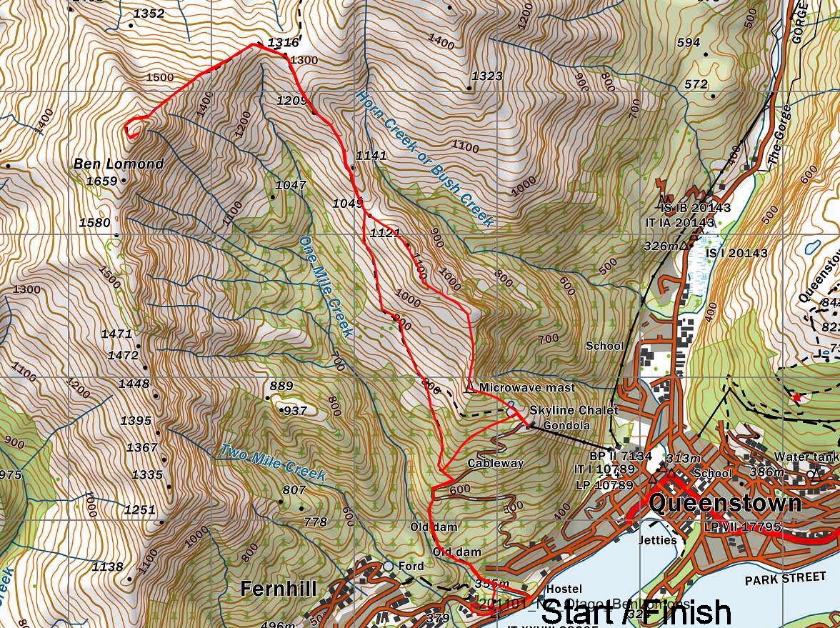
At the top end of the St James Walkway, just off of the Lewis Pass are the Zampa Tops. Forming one side of the Cannibal Gorge, which the St James passes through they make an excellent weekend trip with the potential for an extended tops trip.

We headed up on the Friday night on the back of a so-so forecast for the Canterbury High Country and an excellent one for Nelson Lakes. We camped at Deer Valley on the first night and coincidently met some people who had just completed the tops themselves. They reversed the guidebook route, suggesting the climb up from Ada Pass was much easier than descending this way.


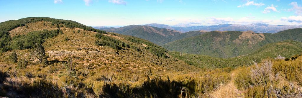
The first part of the route is on the St James Walkway, it was very different to last time we had been here in 2008 - then there was 6 inches of snow on the ground - today it was a mossy green colour. We headed down the St James to the Cannibal Gorge. The following information is given about the gorge:

Before the arrival of the European’s the route up the Maruia River, through Cannibal Gorge was well travelled and popular with Maori. Because of its rich wildlife and easy access to other areas including the greenstone found on the West Coast dispute over this access arose between Ngati Tumatakokiri of Buller / Nelson and the Ngai Tahu of Kaikoura. This dispute ended is grisly fashion when a party of Ngai Tahu were trapped in the gorge by the opposing tribe and later furnished the substance of a celebrity meal for the victorious Ngati Tumatakokiri – hence the name “Cannibal Gorge”


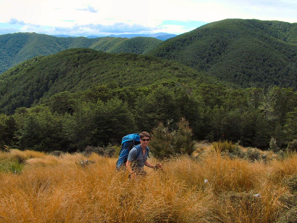
We reached the Cannibal Gorge Swing bridge after 20 minutes and dropped down to the river bank there before following the river upstream to the first major stream on the true left. This stream started off barren and desolate but climbed quite quickly and then narrowed. The bush closed in around it and it gained a lot of character.

At the scrub line we left the stream and climbed steeply on the left hand side to reach a grassy terrace well above the tops. We followed faint animal trails across a small saddle and without almost any height loss arrived at the Zampa Tarn.


This large tarn is fairly shallow and home to a large population of wild geese. We stopped for lunch here and enjoyed a brief spell of sunshine and warmth. There were plenty of semi sheltered camping spots nearby too.


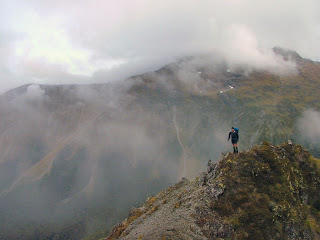
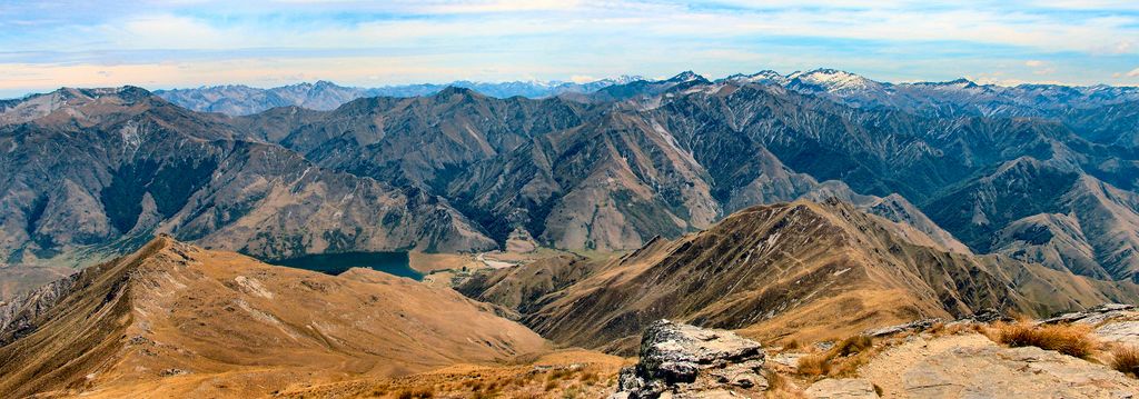
From the tarn we climbed up and traversed the easy ridgeline north over several minor tops before finding a sheltered campsite in a well-drained hollow just off of Pt. 1681. Unfortunately our plans of enjoying a good sunset or sunrise were scuppered as the weather closed in at this point, though we did have the opportunity to see the Spencer Mountains before they disappeared in to the cloud and the route up the un-named stream to Nelson Lakes.


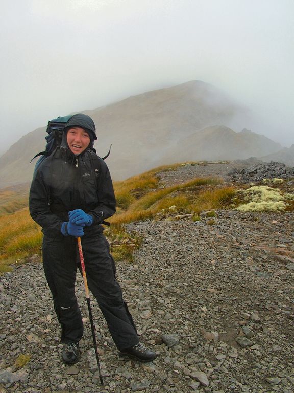
It rained on and off for most of the night; we had a wet tent to pack up the next morning. We descended directly down a spur from the last top to Ada Pass. One short section of this route around the 1500m contour is slightly airy, though not at all technically difficult. In mist finding the correct route would be hard as there are several false spurs dropping directly in to the stream to the north.


The bush bash wasn't bad at all except for the last 100m or so which had a lot of regrowth. We drifted left a lot during our descent and came out maybe 500m down from the Ada Pass Hut and had to mess about in the river bed for a couple of minutes.

The return route on the St James provided very quick travel. An hour or so saw us at Cannibal Gorge Hut where we stopped for a brief lunch and then another two hours of walking along the well-formed track saw us back at the Cannibal Gorge swing bridge. Inevitably the climb back up to the car park at the end seemed much longer than expected, but another 20minutes saw us comfortably back at the Lewis Pass car park.


Mt Herbert from Diamond Harbour

Just a quick trip up Mount Herbert this weekend.

After taking the ferry across from Lyttleton we took the normal route up Mt Herbert from Diamond Harbour.


The hills had the most amazing orange hue this time of year, after the long dry spell.

Of Historical interest on the route is the site of the Henderson House, just up from Diamond Harbour:

These crumbling clay walls are all that remains of the house built about 1880 by Gideon Henderson (1836 – 1918) who arrived in Lyttleton in 1874.

Like many other early smallholders on the southern side of Lyttleton Harbour he was a Shetland Islander.

Henderson leased and farmed land around Diamond Harbour and rowed his dairy produce to the Lyttleton Market in a dingy in all weathers.

The house was two storeyed with an iron roof. The lower floor held two bedrooms, kitchen, dairy, small hallway and a central fireplace. External steps led to a timber frame bedroom above.

Henderson also planted the bluegums.

The house sheltered a considerable family, as Gideon and his second wife Barbara had seven children when they lived here.


We stopped briefly on the summit to admire the views back towards the Port Hills and Christchurch as well as south west to Lake Ellesmere, before heading down to the busy day shelter for a spot of lunch, where we were joined by a good mix of tourists and locals.


We returned by the same route.

Jan 29, 2011

Bob's Camp Biv and Pinchgut

From the weekend 15th - 16th January

A full blown nor-wester, with rain and cloud forecast for the Canterbury High Country saw us heading to the Canterbury Foothills, where the forests would at least provide some protection from the weather. We linked Bob’s Camp and Pinchgut Hut by using the recently remarked tracks on Cattle Peak and Whare Ridge. These tracks, whilst still graded easy are certainly more challenging then the popular day trips to the foothills summits and in my opinion create one of the more worthwhile circuits in the Canterbury Foothills.


We started at Wooded Gully late in the morning and climbed up on to the Mount Thomas Ridge using the main wooded gully track, a popular well graded track that climbs gently up through native bush. A couple of hours later saw us pop out on the ridge above the Whare Stream and we climbed up to Point 1043 where we stopped for lunch, having to sit in the shade because the sun was so strong.


From here we headed North West across the tops. First on an open rocky section, though low sub alpine scrub and then onwards back in to the bush though low stunted forest for an hour or so. Eventually the track broke back out from the bush to tussock slopes and we reached the short spur track to Bob’s Camp Biv.
The two person biv is in good condition, but quite frankly looks like an air raid shelter; luckily there was a good camp spot next to it which we took. Running water was difficult to find. There was a slightly manky pool within 30m of the biv, but finding fresh running water required a descent of around 150m in to the head of the Cattle Stream through moderate scrub. A large outdoor fireplace and meat locker complete the accessories at the biv.


The logbook gives the following information about the biv:

Bob’s Camp is named after Bob Beuege who used to hunt and possum Mt Thomas Forest and had a fly camp on this site. Still actively hunting at about 70+ years old.

We had met a gentleman of that age at the top of track 2, with white ancient hair and a body burnt pink from the sun. After reading the logbook it was easy to believe that it had been Bob….
The wind got up during the night and became quite ferocious, - the bush protected us from almost all of it, though the noise of the wind in the trees kept us awake and also a branch falling on the tent at one point didn’t help matters.
The Sunday morning was a blue sky day but the wind hadn’t abated one bit. The top’s sections of the route presented no danger though and were short lived so we enjoyed getting blown over repeatedly in the biggest wind guests. We took the Cattle Peak route down to Pinchgut Hut which is a nice tops route that drops down a wide ridge, dipping in and out of the bush most of the way.


Morning tea was taken at the hut, which has a beautiful log cabin style construction inside and, judging from the hut book sees quite a bit of traffic, though there had only been one person there the previous night.


We now faced a 600m climb back up to the Mt Thomas Ridge, which we took very slowly. Despite the wind the day was a scorcher. As we neared the top of the ridge, the wind finally started to abate and the day got even hotter.


We didn’t mess about getting back to Wooded Gully – and headed straight down track 2 from the Mount Thomas Ridge. This provided a direct, if somewhat uninteresting descent, the last part through clear felled forest. This open area really reflected the afternoon heat and it was great to get back to the car park and cool off in the shade.

Jan 1, 2011

Queenstown - Ben Lomond

Our New Year's Day walk was up Ben Lomond. This full day walk was a great walk to start the New Year and work off last nights dinner and drinks.


We started from our accommodation in town and walked up the 1 Mile Creek track at Fern hill, though native bush to the One Mile Dam pump house, which was part of the first hydroelectric scheme in NZ.


On the One Mile Track.


The One Mile Dam.

After a short section of track through further native bush, which followed the old pipeline, the track then entered plantation and climbed steeply up through the forest for a while, part of this is on gravel forestry roads, and is shared with mountain bikes. A good track is then picked up which climbs out of the bush and across subalpine scrub to the saddle at 1316m. There are some good spots here for morning tea.


Ben Lomond from near the saddle.

From here the final steep climb to the summit can be seen, the track still of a good standard winds it's way up and sidles around the summit cone before popping out on top. As expected the views are extensive.


Lake Wakatipu from the summit.


On the summit of Ben Lomond.


Looking towards the Southern Alps from the summit.

We returned by more or less the same route, though I continued along the ridge between Bush Creek and 1 Mile Creek to drop directly down to the dreadful Skyline complex, where at least the fact you could sit and watch Para gliders was a slightly redeeming feature.


Paraglider over Lake Wakatipu.

A sidle track then cuts back through the forest and returns you back halfway through the pine plantation above Fern hill.